Learn about drone magnetics
Drone magnetics is a highly technical, complex field. Below is a range of articles to read, learn and understand why both drone magnetics and in particular AirGeoX’s TotalMag system produces the highest quality magnetic data in the world.
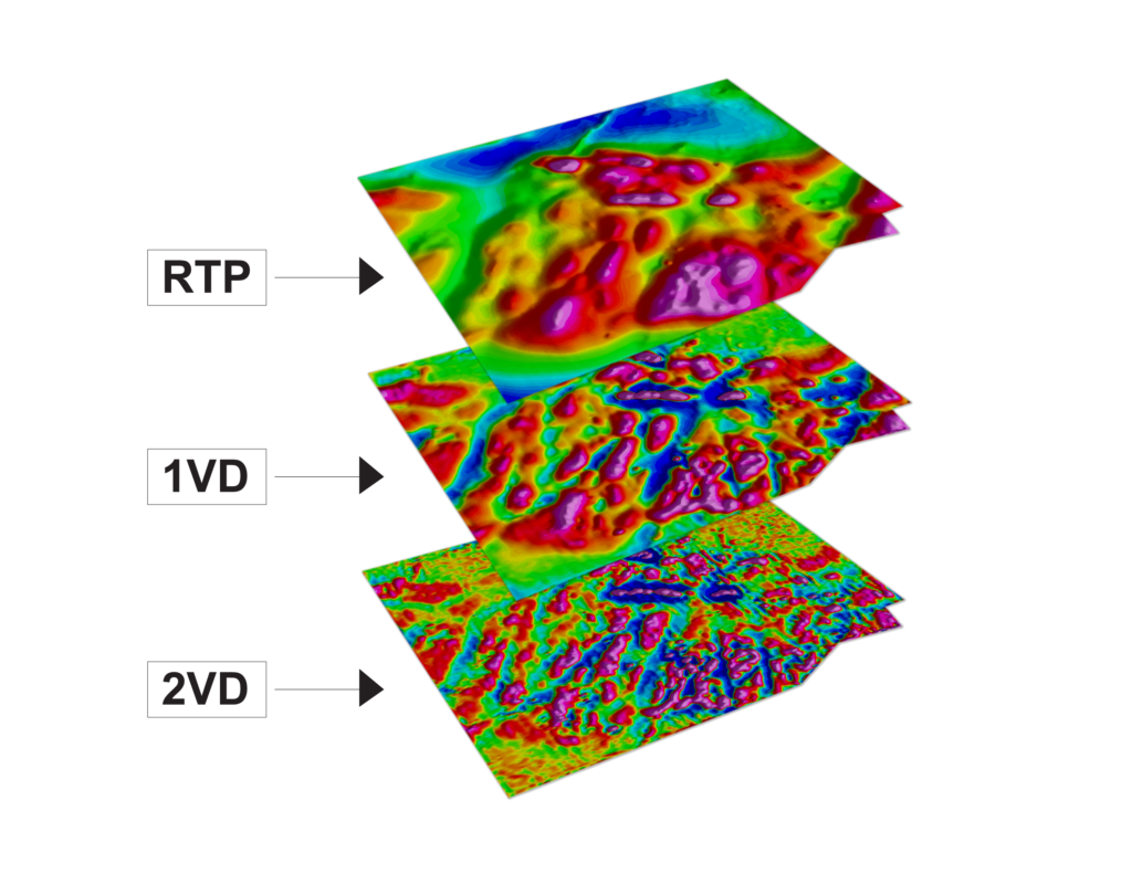
The primary benefit of drone magnetics over manned airborne magnetics is the greater resolution and greater amplitude of geological units primarily from the lower flight height. This allows geologists to map more geological structure that will produce more accurate drill hits and increase the likelihood of hitting a deposit. But just how much greater is the resolution?
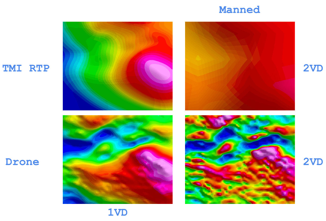
Below is a comparison between an AirGeoX drone magnetic survey (3.5km x 2km) for Aeris Resources Limited that had been flown by Geoscience Australia and released for the Cobar 2021 magnetic survey (https://ecat.ga.gov.au/geonetwork/srv/api/records/146166).
The top image is the Geoscience Australia TMI RTP 2VD (highest resolution produced) image collected by a manned aircraft in 2021. The line spacing was 200m, flown E-W at an altitude of 60m.

Below is the AirGeoX TMI RTP 2VD (highest resolution) image. Lines were flown E-W, 25m line spacing at a height of 30-35m.
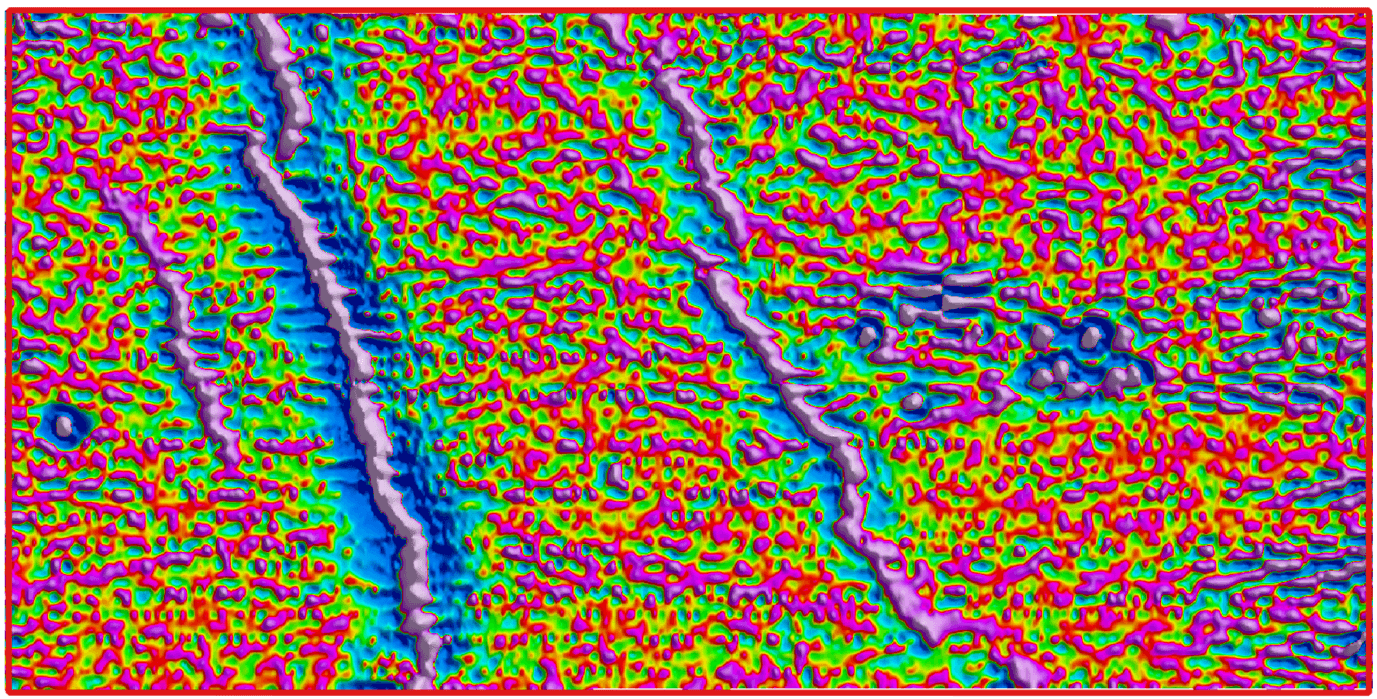
Is this the same area? The client was blown away at the level of detail detected by the AirGeoX drone magnetic system. The ability for AirGeoX to detect structure parallel to the flight path illustrates the extremely high quality and non existence of filtering to produce this result. The drone magnetic survey shows an E-W fabric not seen by the manned survey.
While the comparison due to the wider line spacing of the Geoscience Australia survey, the comparison shows that if you’re a geologist who needs to map geological structure for a future drilling program, you will miss the majority of the structural information if you don’t use a high resolution drone magnetic survey.
This survey shows that while a drone magnetic survey costs more per kilometer than a manned aircraft mag survey, the money is well worth the improvement in resolution.
The value of drone magnetic data is not realised until the data is zoomed into a very high resolution and enhanced to it’s signal to noise limit, such as a second vertical derivative.
With the significant improvement in resolution of magnetic data, explorers, miners and engineering firms will have the confidence to commit resources towards drilling, knowing that any drill holes will accurately hit the targeted geology.
With the significant improvement in resolution of magnetic data, Emmerson Resources will have the confidence to commit resources towards drilling, knowing that any drill holes will accurately target the mineralised structure at Comstock.
The ultra high resolution will also give Emmerson Resources many more targets to drill than had they used a manned aircraft to collect the magnetic data.
The value of drone magnetic data is not realised until the data is zoomed into a very high resolution and enhanced to it’s signal to noise limit, such as a second vertical derivative.
With the significant improvement in resolution of magnetic data, explorers, miners and engineering firms will have the confidence to commit resources towards drilling, knowing that any drill holes will accurately hit the targeted geology.
Below is a comparison between AirGeoX drone magnetic and manned aircraft magnetic data in the WA Goldfields, flown for a major gold miner. Both surveys were flown at 20m altitude, with the drone mag at 25m line spacing and the manned aircraft at 50m line spacing, both E-W orientation.
The drone mag illustrates greater amplitude of the anomalies, higher resolution, more geological structure can be mapped, which may make the difference between drilling or missing a deposit. A drone magnetic survey costs more per kilometer than a manned airborne survey, but as you can see, the additional expense is worth the money if it allows you to map gold hosted structure that my not be visible from a manned aircraft survey.
AirGeoX completed this 840km survey in 5 days, delivered raw data the next morning after flying and delivered the final data two weeks later with no safety issues at all. This illustrates that drone operations have matured. They are no longer slow and fraught with difficulties, they are reliable, repeatable and able to acquire large survey areas quicker than ever before. As we move into the future, fixed wing drones will start to acquire data at a similar rate to manned surveys, making manned surveys redundant in the future.
Request AirGeoX to quote and we will show you how fast we can acquire, process and deliver your data.
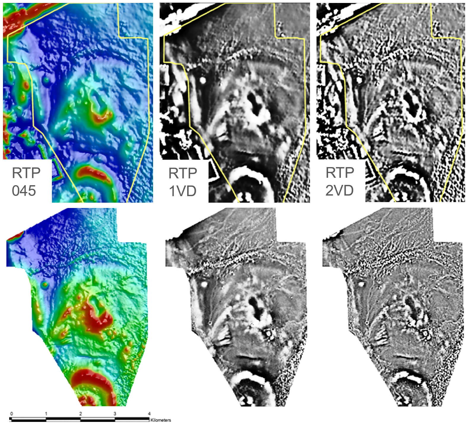
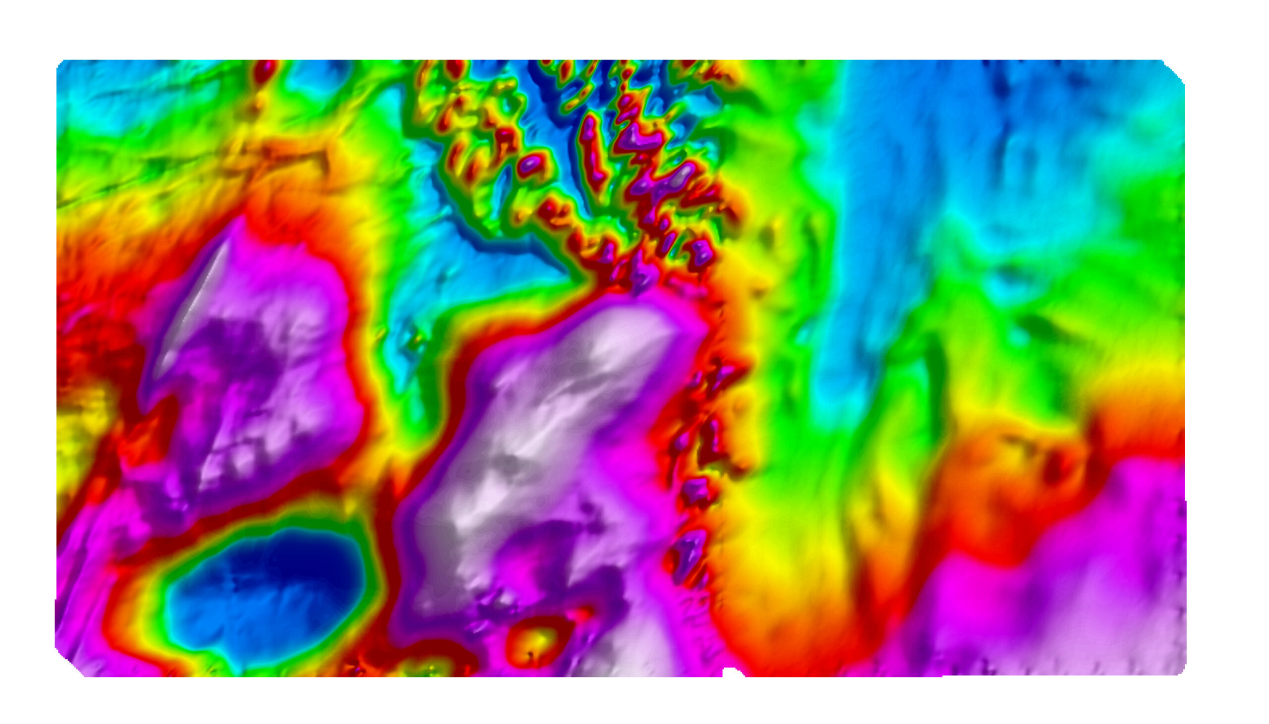
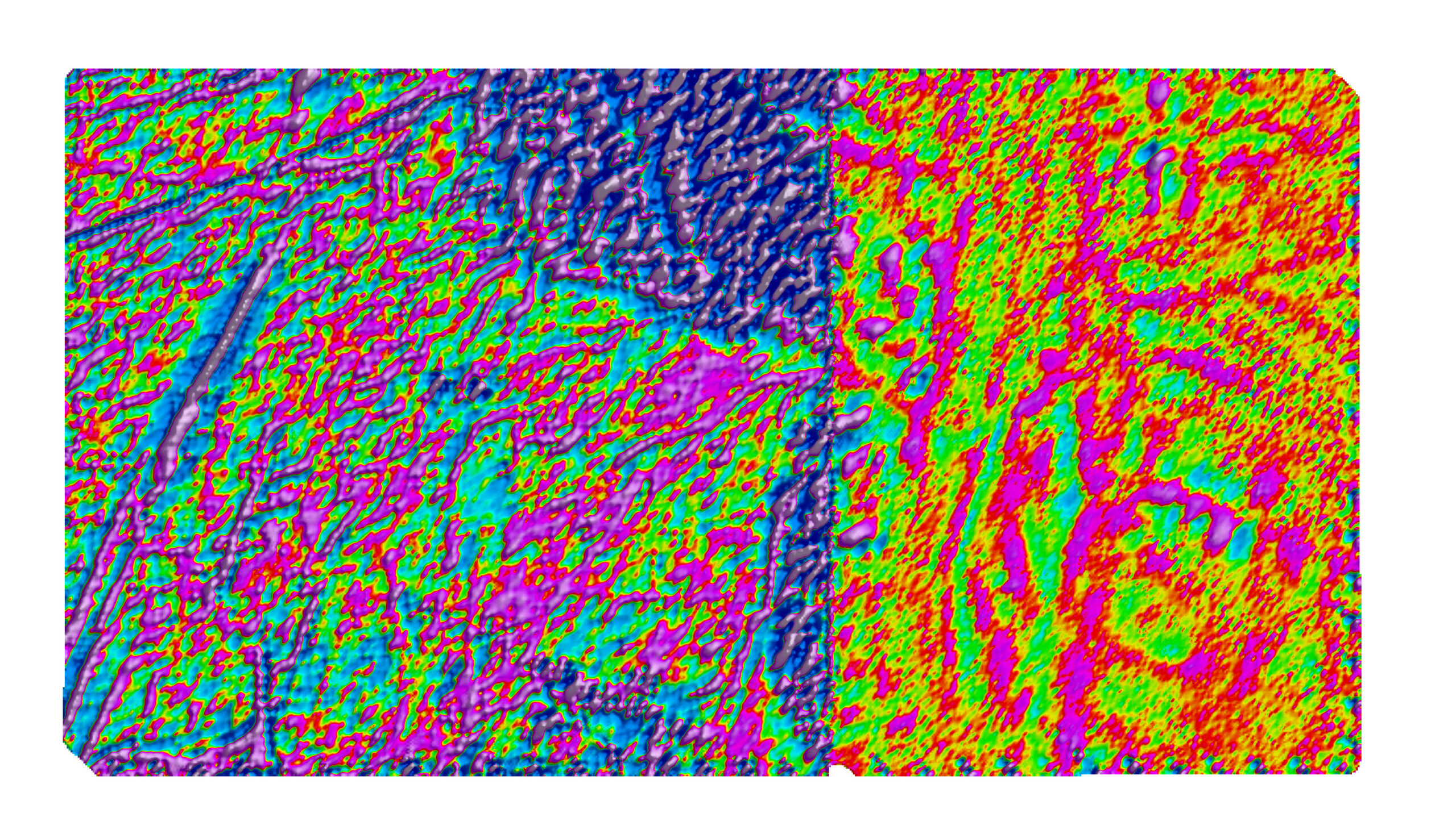
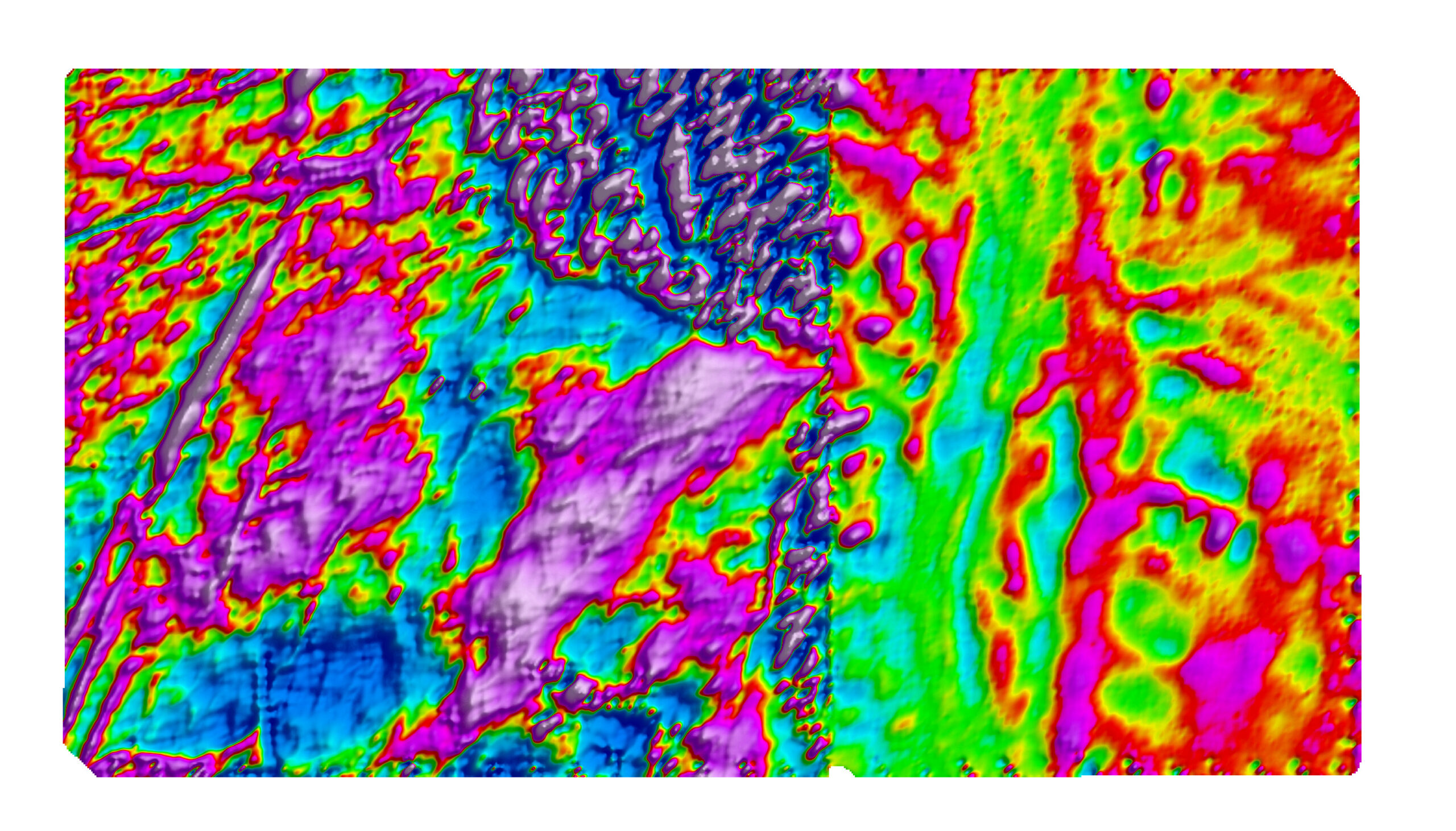
An interesting case study came up in a drone magnetic survey flown for Investigator Resources Wiawera and Olary prospect. The area has historic structurally hosted Au-Ag-Cu mineralisation associated with magmatic intrusions, so an ultra high resolution magnetic survey is required to accurately map the precise location of the intrusives.
In order to map as much structure as possible, the survey was planned to be flown at an altitude of 20m, however a 30m high tree line was present on the eastern side of the survey area. In an effort to give Investigator resources the highest possible resolution data, the western side was flown at 20m altitude and the eastern side over the trees was flown at 40m.
The adjacent height difference produced an interesting case study into the effect of increasing height only as all other specifications remained the same. A general rule of thumb dictates the minimum wavelength or width of geological units able to be detected is a 1:1 ratio with the flight height. Also the magnetic susceptibility of a geological body decreases at a rate of between 1/r and 1/r3 depending on the source shape, meaning less geological units will be detected as subtle responses will decrease to an amplitude under the noise level of the magnetometer. This information is important, because the height of data acquisition is the main difference between whether a client should choose a drone magnetic survey or a manned aircraft survey.
What we see is a subtle difference in the TMI RTP grid, to a noticeable difference in the TMI RTP 2VD grid. The 2VD grid is the primary grid used for mapping the geological structure and intrusives associated with mineralisation. The first thing we notice is that many of the 20m wide SW-NE trending intrusives in the west are not detectable in the east primarily due to the lower resolution. We notice that the texture of the response due to granite in the north changes across the boundary, perhaps resulting in a different interpretation of the geological units present. The amplitude of the response decreases and the noise increases in the East. The noise is a gridding artefact due to the wavelength along line being 40m, but across lines being 20m, due to the 20m line spacing. This difference in detectable wavelengths has caused this artefact, which could be improved with further filtering.
The data illustration shows that 20m height difference doesn’t sound like much, but it can make a significant difference to the geological interpretation derived, which flows down to the likelihood of hitting mineralisation when drilling.
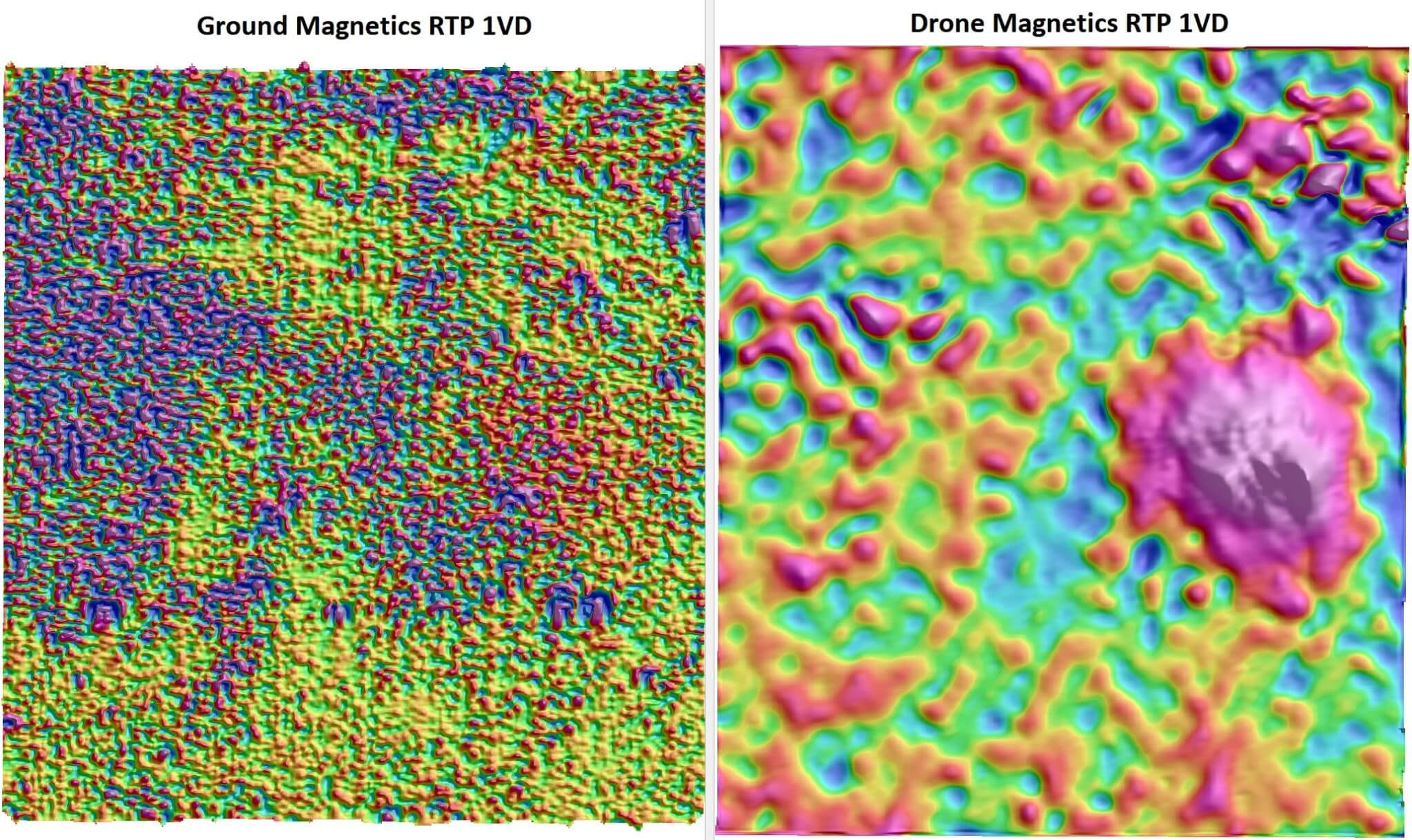
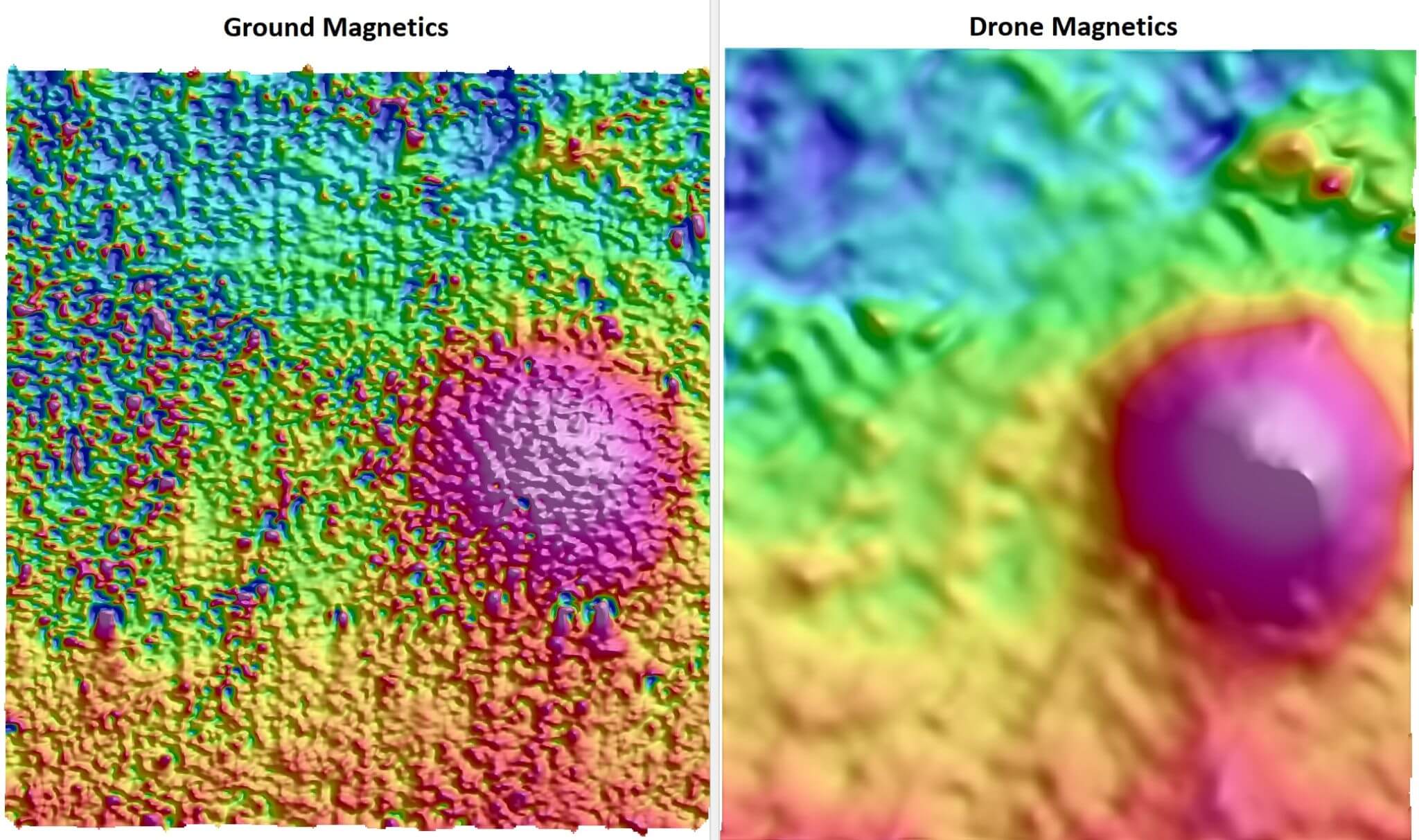
You may assume ground magnetics will give you a higher quality dataset than drone magnetics, but you may be wrong.
If there’s any variable weathering or maghemite present this produces high amplitude noise that obscures underlying geology.
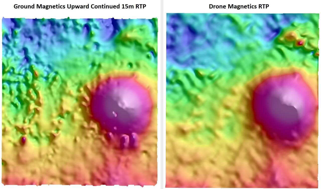
The maghemite that has plagued this ground magnetic survey is small in comparison to the underlying geological response, so a natural way of removing the high frequency noise is by moving the magnetometer 15m up, away from the noise. The magnetometer can only identify wavelengths of signal that are greater than the distance to the magnetometer, so it won’t identify the maghemite noise.
The images below are were both collected with the same 10m line spacing in the same northerly orientation. The difference is that the drone data is flown at 15m altitude, which acts as a filter to remove all wavelengths less than 15m.
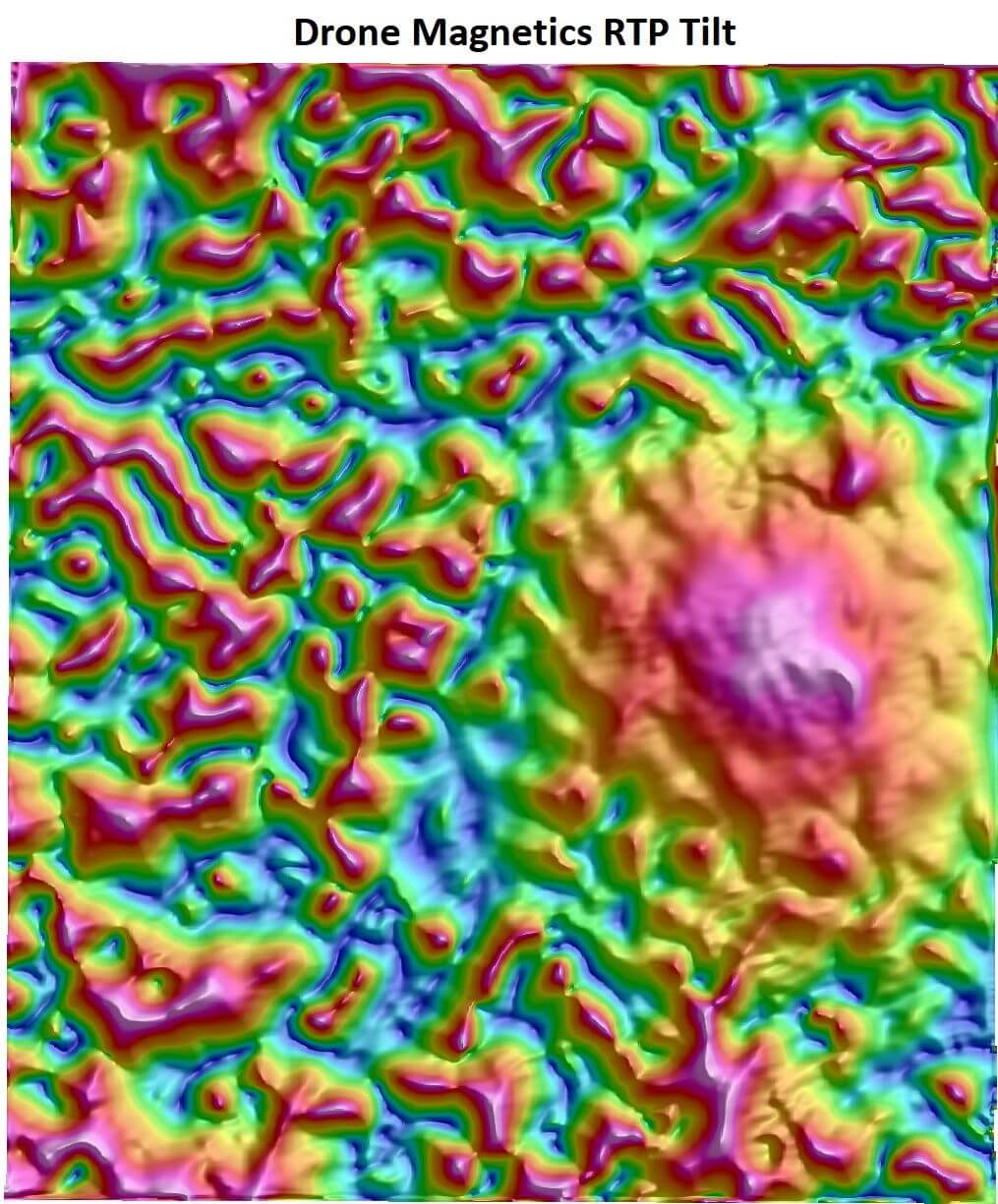
Enhancement filters, such as the 1VD shown don’t produce a coherent response with the ground magnetics where as enhancement filters applied to drone magnetics aids geological interpretation.
Thank you to Emmerson Resources for supplying the data.
If you would like to discuss the magnetic signature of maghemite or any variable weathering, please contact AirGeoX.
The number one advantage and reason why all explorers should choose a drone magnetic survey rather than a manned airborne survey is to fly lower and therefore closer to the geology you’re looking to map.
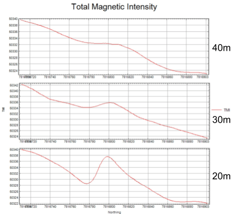
At AirGeoX, we flew 3 lines at varying heights to calibrate the laser altimeter, GPS height and tow cable length under the drone.
The images below are of the raw magnetic response at an altitude of 40m, 30m and 20m respectively, which has a near surface anomaly under the line.
The anomaly goes from nearly undetected at 40m altitude, to a 2nT anomaly at 30m altitude, to 9nT anomaly at 20m.
The effect of moving only from 40m to 20m altitude changes the response from not detecting the geology to having a booming anomaly, many times above the background.
The effect on a magnetic grid is to map more geological structure and units, with greater definition and amplitude and it allows you to produce more enhancements to the grid to illustrate the geological unit you’re looking to map.
AirGeoX routinely flies surveys at 15m altitude with no risk to the safety of field crews.
What anomalies are you missing, flying at a higher altitude?
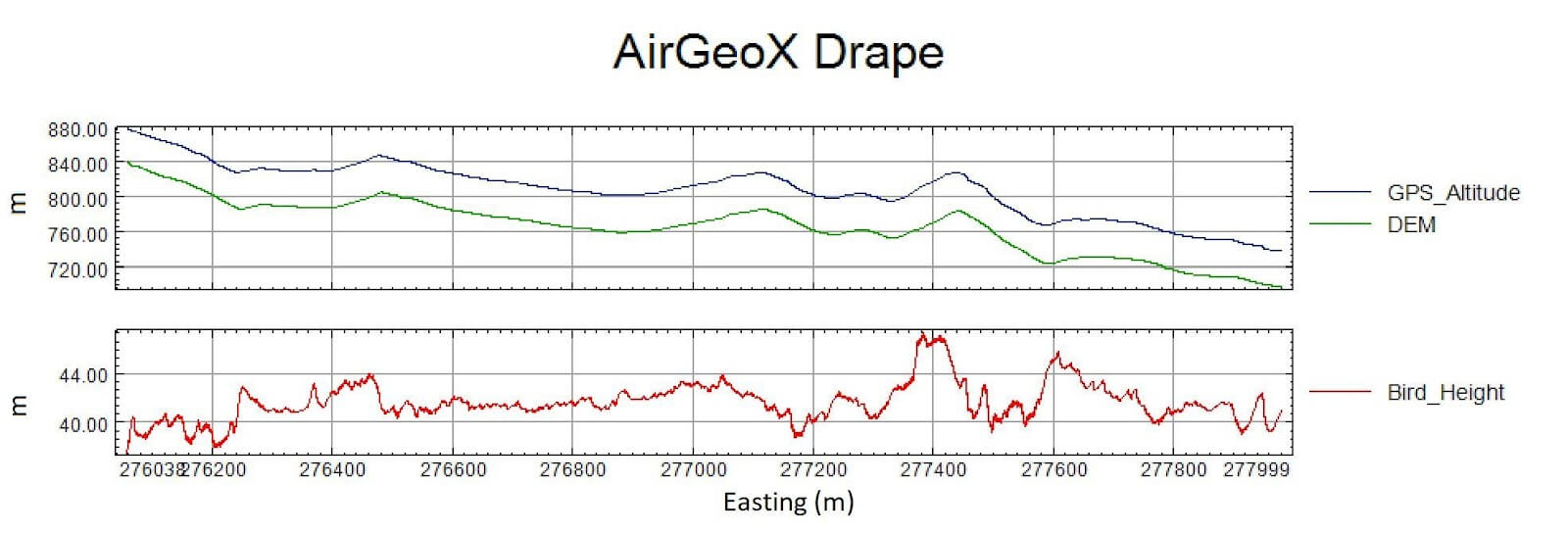
AirGeoX have acquired airborne magnetic data in very steep terrain, 25 degrees plus for some surveys. I’m amazed at just how hard AirGeoX’s drones climbing and descend over the hills and how accurate the drones drape the terrain.
Very high quality magnetic data needs to have minimal height deviation from the ground, due the between 1/r and 1/r3 rate of attenuation. Any height deviation between lines will produce striping in the data which obscures the geological structure. Therefore AirGeoX use only high end electronic sensors to produce the most accurate drape as possible.
For steep terrain in the past, the go to was always a manned helicopter, but how do helicopters compare with the new kid on the block, drones.
Below is an example of similar topography heliborne data from Geoscience Australia. The results are obvious as to which is better. A drone computes and adjusts it’s height, line, speed, pitch, roll and yaw 100 times per second. The adjustments made are as small as 1/1000 of a rotation of individual rotors. A manned pilot can’t compete for accuracy with the high end electronics employed by AirGeoX.

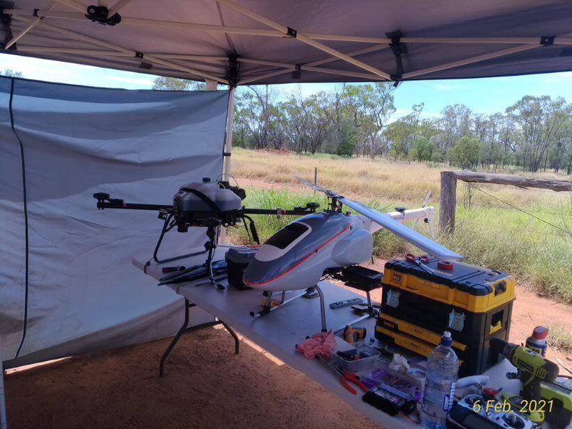
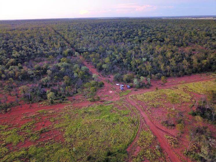
AirGeoX are fully equipped to complete a drone magnetic survey anywhere, no matter how remote.
We have flown a survey in every state (including NT) in Australia (except Tasmania, does that count as a state?)
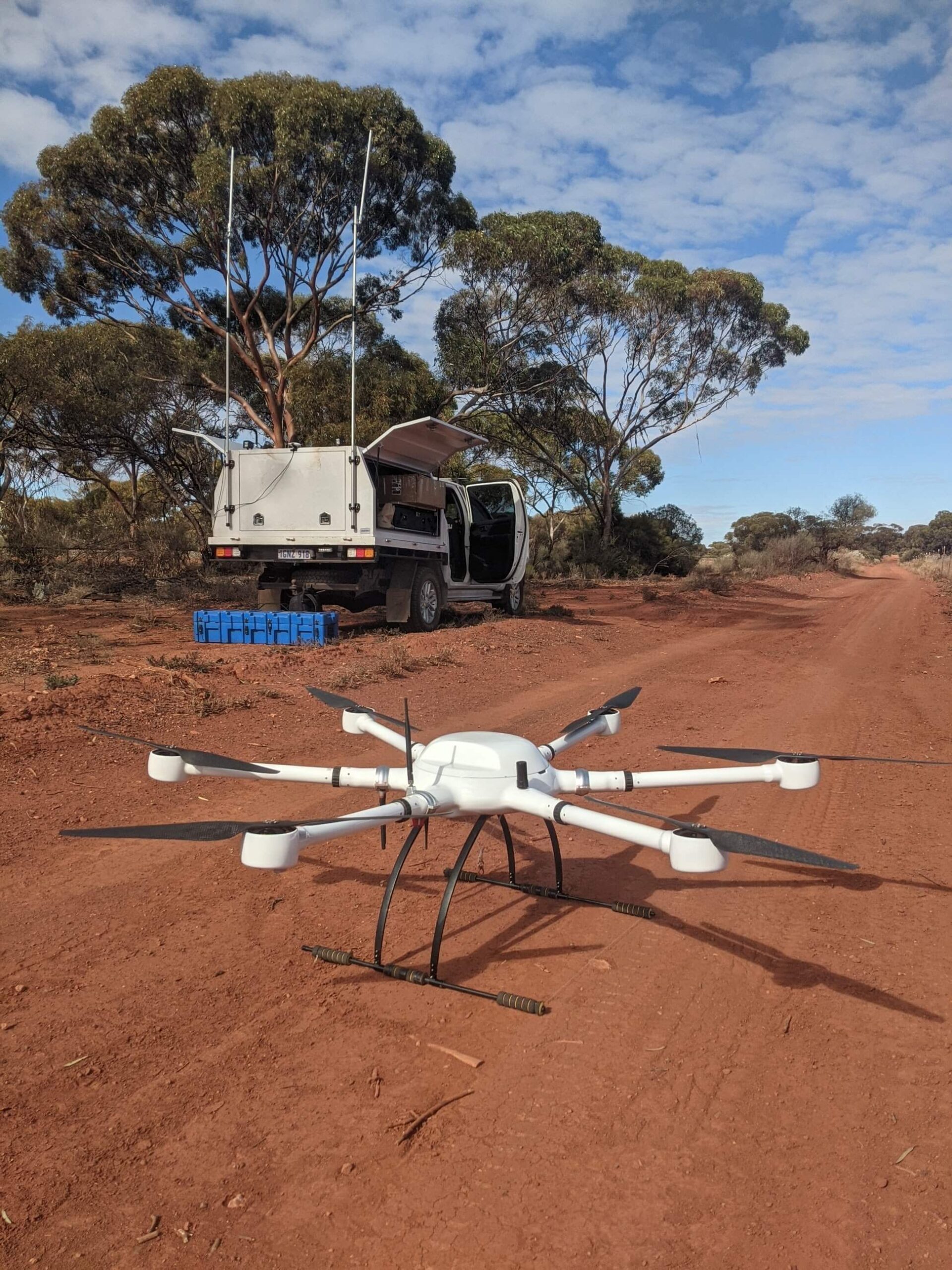
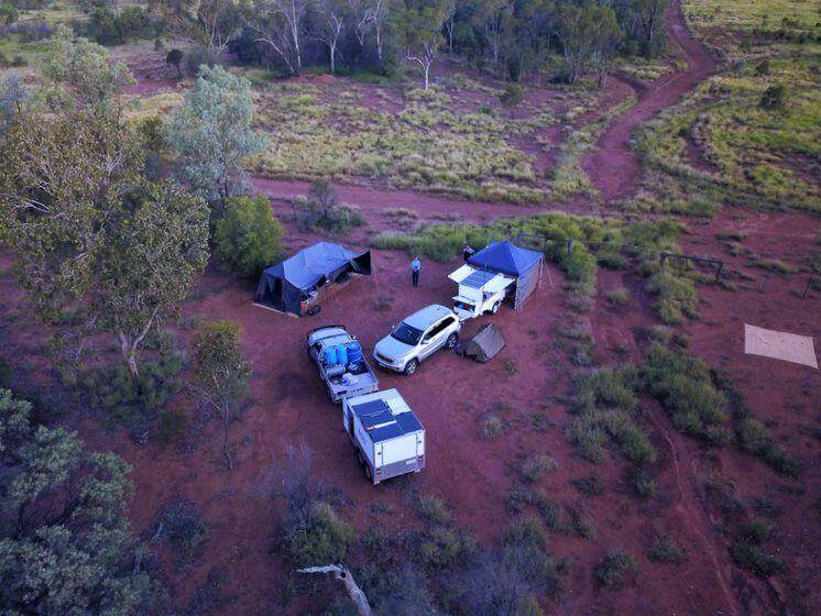
We have done field campaigns of up to 4 weeks camping remotely with more than enough supplies to last us with heaps of water, spare fuel, fridge and pantry full of food.
All electronic equipment, including Starlink internet, lighting and all power run off solar panels and batteries. We do however use a generator for half the day to charge the drones batteries.
Copyright@2022
