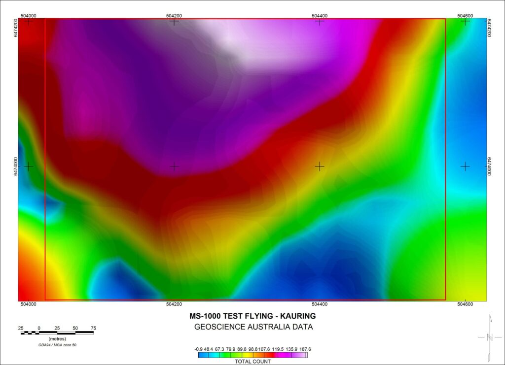
The benefit of drone radiometrics is a lower flight height, which produces a significantly smaller footprint and therefore higher resolution data. The footprint is reduced from approximately 100m for a plane flying at 50m altitude, down to 30-40m for a drone flying at 20m altitude.
AirGeoX have chosen to operate the Medusa MS-1000 spectrometer as it’s a large CsI crystal with 1000cc volume, 4 times larger than other drone spectrometers and it has the ability to acquire and deliver up to 2048 channels at varying sample times.
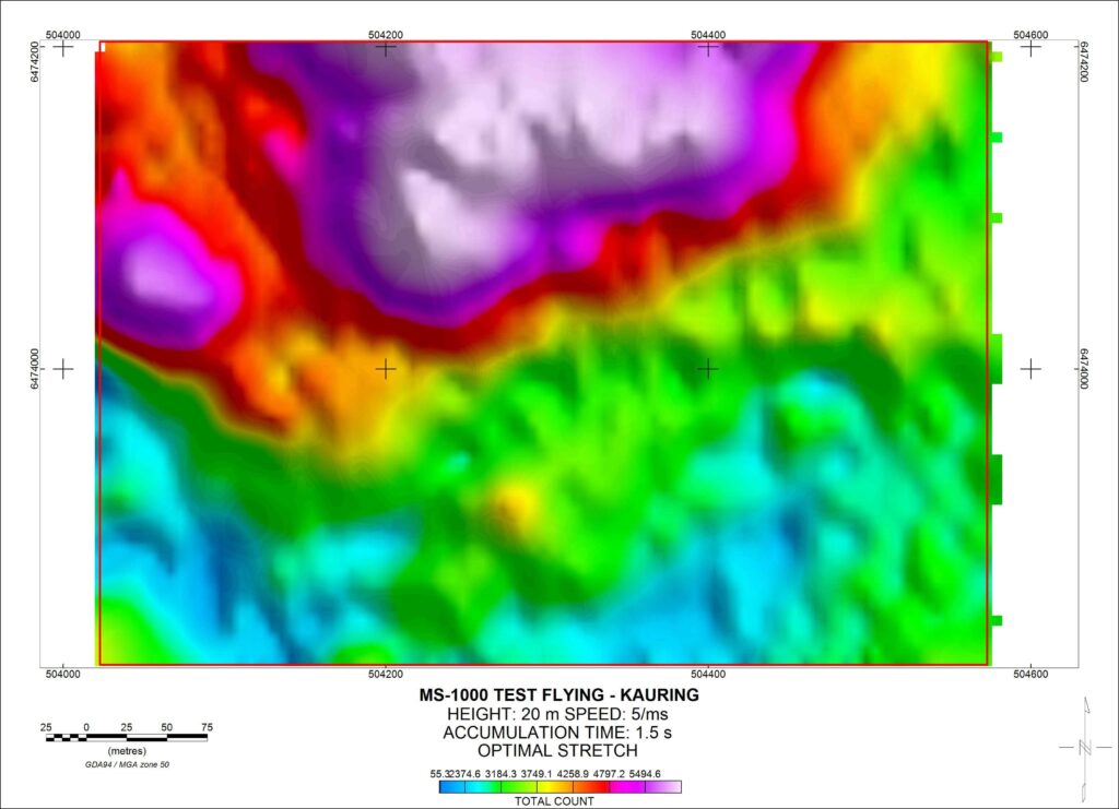
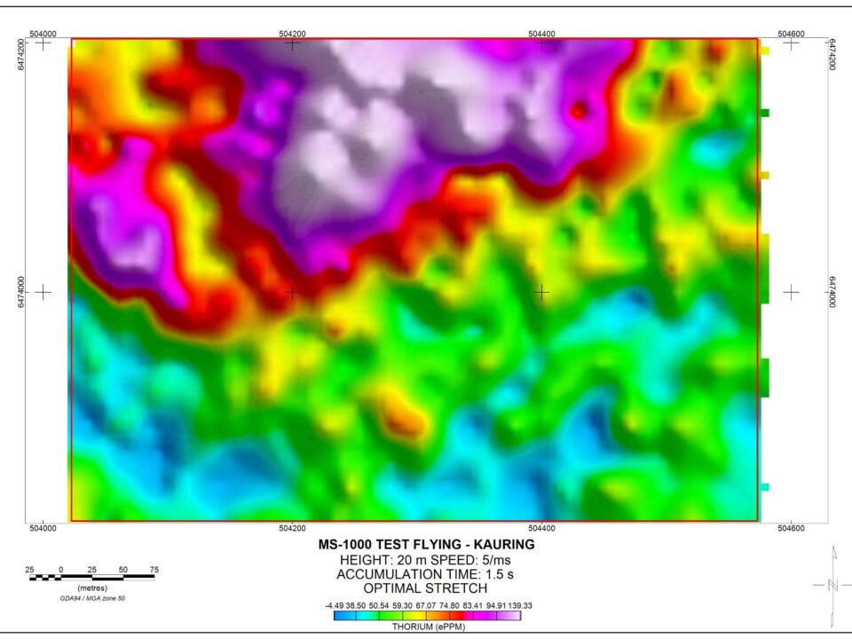
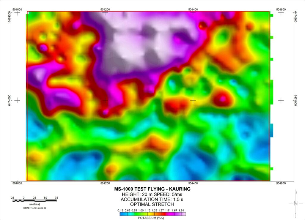
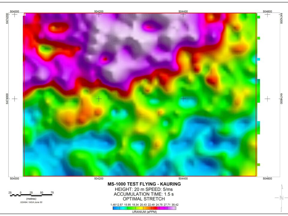
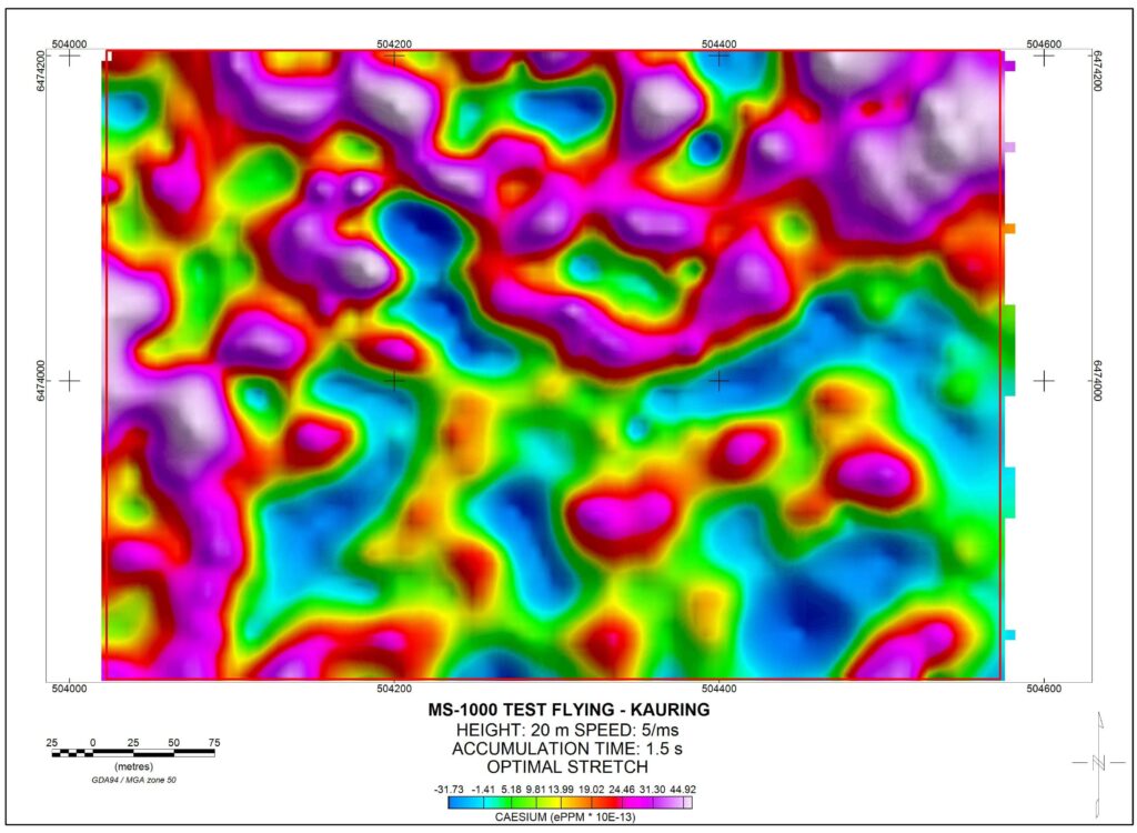
A challenging test area with very low counts and no outcrop clearly illustrates geological structure of 25m resolution, when flown at 20m altitude and 25m line spacing. Many small scale structures are identified that could otherwise only be identified by walking a spectrometer.
Drone radiometrics has the ability to map Cesium, which is useful for detecting outcropping lithium. The maximum amplitude of Cesium in the area is a total of 70 x 10-13 PPM, which illustrates the excellent signal to noise ratio at such low signal strength.
Drone radiometrics has the ability to map Cesium, which is useful for detecting outcropping lithium. The maximum amplitude of Cesium in the area is a total of 70 x 10-13 PPM, which illustrates the excellent signal to noise ratio at such low signal strength.
If you’re an explorer for Uranium, rare earth elements, lithium or require any high resolution structural mapping over outcropping areas, drone radiometrics will produce a higher resolution and high quality dataset not able to be produced by any other method.
The drone spectrometer is also available for environmental mapping and agricultural mapping.
The drone spectrometer is also available for environmental mapping and agricultural mapping.